Martcrag Moor
Location
Between Pike O’ Stickle and the Stake Pass. Grid ref: NY265084
Legal status
A path on open access land.
Path use
The path connects the Langdale Pikes with the Stake Pass and Cumbria Way long distance route. It is mostly used to get from the Langdale Pikes either down into Langdale or Borrowdale via Stake Pass, or across to Angle Tarn.
Historic interest
In early 2008 a member of the public noticed strange looking stones along the path, which had become exposed as the peaty ground was worn away by feet and water. Archaeologists were called in and discovered six small working floors where people had stopped to make rough-out axes and other tools during the Neolithic period. The stones were the piles of waste flakes left behind at the work sites several thousand years ago. This was unusual as this was the first working discovered away from the source of the stone. The experts were keen to preserve the remains of the ‘axe factory’ so photographed and recorded it using GPS. They then requested the path was repaired as a priority to prevent path erosion damaging the archaeology.
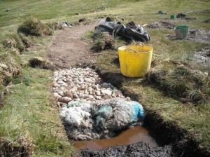
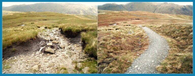
The problem
Part of the path leading down onto the moor had been heavily eroded, creating a large scar in the surrounding peat. Below this, the path virtually disappeared as walkers were forced to cross a very large, very deep bog by taking whichever route looked the least treacherous. Trampling was starting to damage the fragile ecology. Due to the extensive erosion from repeated footfall and the action of surface run-off, large peat ‘hags’ had formed and were receding due to exposure to the elements.
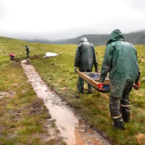
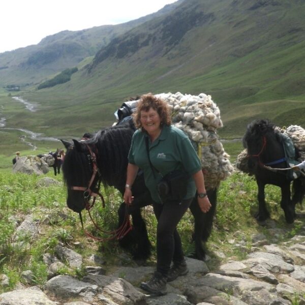
The extensive archaeological interests meant that machines could not be used. Similarly, pits could not be dug by hand to provide pinnel for the path surface. Instead, a digger was used to fill bags with gravel from an eroded drumlin in the Langstrath valley and these bags were then flown to site by helicopter.