Levers Water to Swirl Hawse
Location
3km north west of Coniston
Legal status
Public Right of Way (“PROW”) footpath
Path use
Offering an easily accessible escape into ‘wilderness’ from Coniston, the route up from Levers Water to Swirl Hawse has become increasingly popular in recent years. The route forms part of a round walk via Swirl How and Levers Hawse, a circular route up Wetherlam and a longer round of The Old Man of Coniston. Relatively untouched by path work, the route has a ‘natural’ feel befitting the landscape it moves through.
Historic interest
The lower section is an old mining access track.
The problem
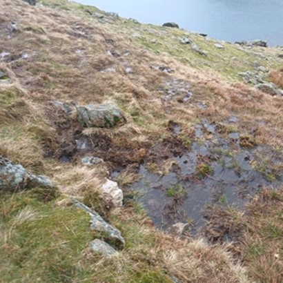
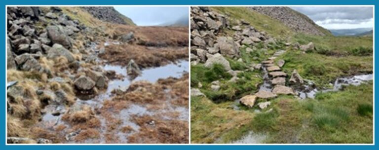
Just above Levers Water, the path line splits into two distinct braids that diverge for about 60 metres before topography brings them back together. While the PROW hugs the rockier side of the valley, an alternative line spreads out over visually more inviting ground. People both ascending and descending the path find themselves on the non-PROW line, which goes over vulnerable peatland. Over time the non-PROW line has become dominant resulting in erosion of valuable habitat, vegetation loss and sediment loss into Levers Water to the point where the ROW was barely visible when approaching the route from the south. This was not a sustainable situation for the peatland.
Repair techniques
2023 works focused on attracting footfall away from the vulnerable line and onto the PROW by :
Keeping descending walkers on the PROW
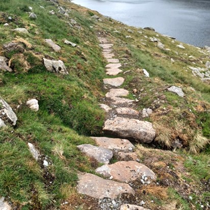
A wet area was pushing downward walkers away from the PROW and onto the vulnerable peatland. A 15-metre run of stepping stones were laid to (a) present a dry and sustainable line, and (b) to provide a visual draw away from the vulnerable line. This is the work shown in the Before & After above.
Attracting ascending walkers onto the PROW
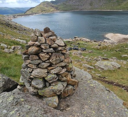
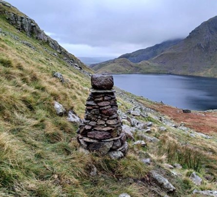
The solution here was to provide visual prompts to attract uncertain walkers. Formal cairns were constructed to draw walkers onto the PROW. Less formal structures would likely have become lost in the landscape. If the correct line becomes established as a clearly defined tread, it may be possible to remove the cairns.