Crag Hill to Coledale Hause
Location
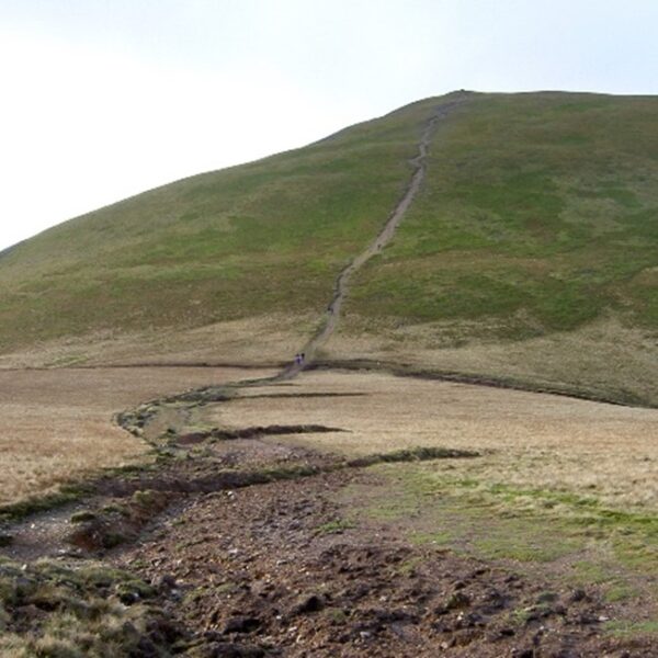
West of Crummock Water and Grasmoor, on the path down to Coledale Hause from the col between Grasmoor and Crag Hill. Grid ref: NY186204.
Legal status
Public Right of Way footpath.
Path use
The path is used as part of a number of circular walks from both the Buttermere and Newlands valleys.
Historic interest
The path was barely visible on the ground in the late 1980s, and when surveys were completed in the early 1990s it looked like a route just trodden by sheep.
The problem
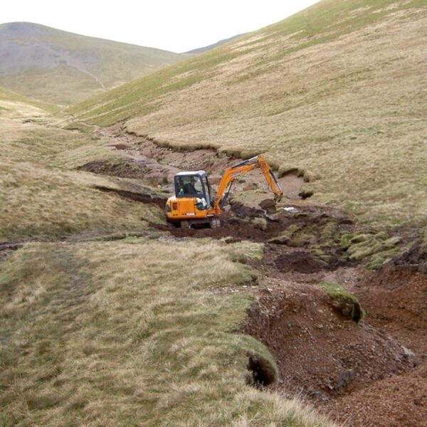
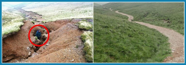
The position changes rapidly after periods of heavy rain as the substrate in this area is very fine. When you get a lot of water on it, it becomes unstable and the path erodes downwards, rather than becoming wider. Vegetation is critical in holding it all together.
The deep gully you can see in the photo used to be the deepest path erosion scar in the Lake District. It was caused by water gathering from the fellside onto the path higher up over a length of perhaps 0.5km. When the water flowed down to this point, it was channeled onto this narrow section of path, washing a 300m section away. All the material, thousands of tonnes, ran into the watercourse and eventually ended up in Crummock Water. Such heavy sedimentation causes real problems for marine life. Similar problems after Storm Desmond in 2015 severely impacted the char in Buttermere.
Trampling was also damaging vulnerable vegetation further up the slope as people tried to avoid the worst eroded areas.