Armboth – High Tove to High Seat
Location
Above Thirlmere, to the west
Legal status
None
Path use
This path forms part of a route along the tops of the fells between Derwentwater/Borrowdale and Thirlmere and features in a number of circular walks. It includes 4 Wainwrights and is therefore popular with “baggers”.
Historic interest
None known
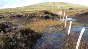
The problem
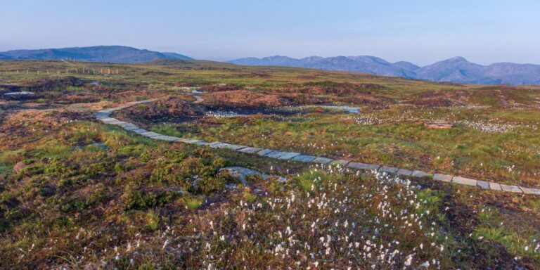
Armboth Fell, regarded by Alfred Wainwright as the centre of the Lake District, is a popular route for walkers. It is a designated Site of Special Scientific Interest (SSSI) and, along with the other Lake District High Fells, supports a huge area of blanket bog. Upland peat bogs act like sponges, storing water and slowing the flow of water into our rivers. This provides both flood relief during heavy rainfall as water soaks into the peat instead of rushing into the rivers, as well as easing the pressure in droughts as water drains gradually from peat into rivers to keep them flowing. Healthy peat also captures and stores carbon, helping mitigate against the effects of climate change.
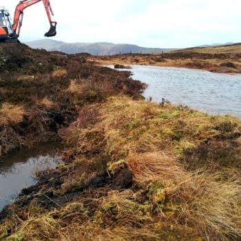
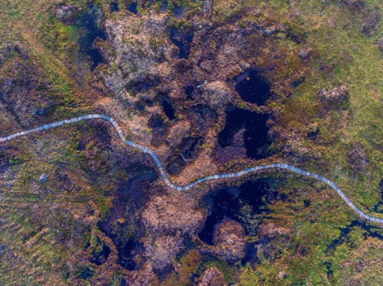
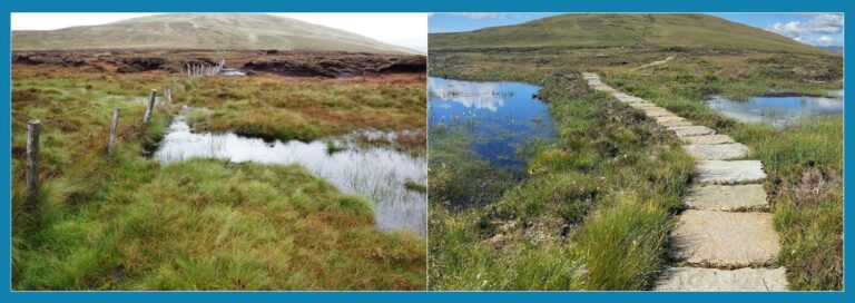
The flattish, lowest section between High Tove and High Seat (both Wainwrights) is called the Pewits and it had become unsafe to cross due to years of unabated erosion. There was no safe or dry route through this section, so walkers and livestock were forced ever wider searching for a dry route, spreading the erosion further. These recreational and grazing pressures had damaged the peat which had dried out and eroded. In its degraded state, water runs off the surface of the bog, rather than being absorbed into it. This run-off also carries a lot of dissolved organic carbon into the catchments of rivers and drinking water supplies, causing problems for native wildlife and increasing the treatment costs of drinking water.
A partnership project bringing together the National Trust’s Riverlands project, Cumbria Wildlife Trust, United Utilities, Fix the Fells and Natural England, was formed to work to restore the peat bog and reverse the damage.