2024 Work Programme
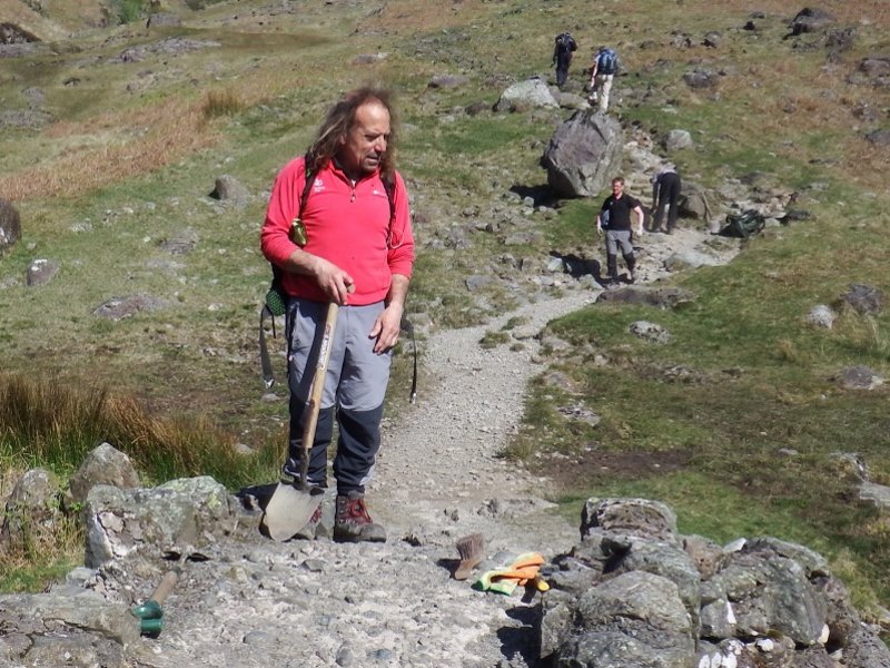
Fix the Fells repairs and protects damage caused by erosion to the fragile upland landscapes in the Lake District National Park. In practise, this work is centred on upland paths as this is where traffic from path users combines with steeper gradients and water run-off to create conditions which can lead to rapid erosion and damage to upland habitats.
Fell path repair work is prioritised and agreed by the Fix the Fells Partnership Board, which comprises representatives from each of the five partner organisations; the National Trust, the Lake District National Park Authority, Friends of the Lake District, the Lake District Foundation and Natural England.
The prioritisation of which paths we work on is based on the current condition of the paths and the future impact they are likely to have on the upland landscape, ecology and archaeology if not addressed. Our Ranger teams draw up detailed specifications each year using nationally agreed best practice principles. For more details please visit our Path Repair Techniques page.
Outline information on the paths under consideration for repair during 2024 is given below
Paths Identified for Work in 2024
All repairs are subject to securing permission from the land owner, the appropriate consents, practicalities and funding. The list is subject to change depending on these and other factors, such as extreme weather events.
Coast to Coast
Fix the Fells are working in partnership with the LDNPA in delivering work on Wainwright’s Coast to Coast path as part of its upgrade to a National Trail. The LDNPA has multiple strands of activity to deliver the route within the Lake District including practical work repairing or improving sections of the path (including the work being undertaken by Fix the Fells). For further information please refer to the LDNPA webpages Upgrade of Wainwright’s Coast to Coast to National Trail : Lake District National Park
Levers Water to Swirl Hause – Footpath
One of the larger projects which will likely continue over into 2025. There is no clearly defined line for walkers to follow, so users are spreading out and causing several deep braids and erosion scars across this sensitive habitat. Work will be completed at intermittent sections along the path to address the most pressing issues Rangers will put in drainage, stepping stones, small sections of pitching, and other and soft landscaping and line definition techniques to keep people on a sustainable route.
Far Easedale – Bridleway
This is part of the Coast-to-Coast path. The work that is to be carried out here is ensure that this is a sustainable path and is not further eroded by the increased level of use expected along a National Trail. The work to be carried out will include pitching, the installation of stepping stones, stone revetment, and causeway.
Further South, along the section down towards Grasmere, working in partnership with Kendal College, Rangers will lead a series of work parties with Outdoor Studies students to repair damage to the path and the surrounding habitats.
Tongue Gill to Grisedale Tarn – Footpath (bottom section) & Bridleway (top section)
This is part of the Coast-to-Coast path. The work here will be undertaken by Rangers and will involve stretches of pitching, the installation of stepping stones and path definition work.
Striding Edge – Footpath
The infamous ‘Striding Edge’ approach to the summit of Helvellyn involves scrambling along a narrow ridge and remedial work is required where there is a significant amount of loose material that needs to be cleared. A small amount of stone pitching needs repairing in order to protect the route from further erosion.
Haweswater Lakeshore – Footpath
This is part of the Coast-to-Coast path. Haweswater is one of the Lake District’s large lakes and a popular destination with increasing numbers of path users.
As part of our Coast to Coast works we will be upgrading the path where it leaves the Haweswater Lakeshore path to go up Kidsty Pike. The path goes through a wet flush, and through a combination of stone pitching and subsoil path we will be creating a single sustainable line to protect the fragile habitat around it. This work will be undertaken by Rangers and volunteers.
Scafell – Footpaths and Permissive paths
The various summit paths around the Scafell Massif have very little in the way of formal pathwork. To encourage and maintain a clearly defined line through these rocky landscapes our rangers undertake very “light touch” work including subtle path definition by careful positioning of boulders and other subtle interventions. It is unlikely that the work on these paths would be noticeable and this is exactly the intention.
Lingmell Nose – Popular route on open access land
A popular path for a steep ascent up Scafell Pike. The work that is being carried out here will encourage users to keep to the defined path. Small sections of stone pitching and drains will be installed to keep water of the path and address braiding of the path and to define it into one line, which will be more robust to use. Landscaping will then be carried out to further define the path.
Brown Tongue – Footpath
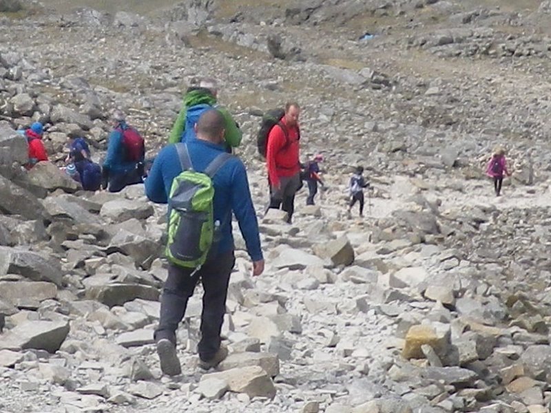
The shortest and fastest route to the summit of Scafell Pike from Wasdale Head Car Park and a very popular and busy route. This is a continuation of previous year’s work. Old, narrow, substandard pitching is being replaced with new pitching, more drainage, wider, and to a modern standard. This path is so heavily used that it requires annual attention as experience has shown that the standard of the path rapidly declines without it. Work will continue this year with further stone pitching and some landscaping to repair short cuts and parallel path lines which are damaging the area around the path. Seed will also be spread on the nose of Brown Tongue to try and encourage re-vegetation.
Corridor Route – Footpath
This route is arguably the most popular route up to the summit of Scafell Pike, starting at Seathwaite in the Borrowdale valley. A busy route used on ascent/descent of Scafell Pike. The path is poorly defined so users spread out causing erosion and water damage. Areas adjacent to the path are particularly wet so prone to erosion and damage.
Great Gable – Footpath
Great Gable stands to the north-east of Wastwater and is one of the most iconic fells in the Lake District. The work that will be carried out here is repairs to existing pitching with the Ranger Team carrying out repairs section by section as required.
Loft Beck – Footpath
This is part of the Coast-to-Coast path improvements to make the Coast-to-Coast route into a National Trail. The aim of the work being carried out here is to get the existing path into a more sustainable condition. Most of the work is to stabilise the path close to the beck as there is soil being lost into the watercourse due to the action of the river and pressures from users spreading out looking for a way round the erosion. The work will include revetment, stone pitching, drain installation, path definition work and landscaping. Sensitive landscaping will be carried out to protect the area from future erosion and provide a single line where users are currently spreading out.
Gowbarrow – Footpath
The circular walk from Aira force to the summit of Gowbarrow is a popular route especially for visitors to Aira Force, linking in nicely with the path network around the river and waterfall. The walk to the summit provides impressive views of Ullswater and the surrounding higher peaks such as the Helvellyn Range.
Fix the Fells Rangers and Volunteers have been undertaking annual path repairs on Gowbarrow since 2013, when sections of the path were suffering badly from water damage. The route became boggy and impassable during periods of heavy rainfall. Aggregate was used to lay paths across badly eroded and wet sections, along with the installation of drains.
We will be working again on Gowbarrow in 2024, continuing with the work of previous years. We are planning to have another 50 tonnes of aggregate lifted onto the fell, as well as more stone for additional drains. As part of our ongoing maintenance programme, we will be revisiting some of the work from 2013/14. Trees will also be strategically planted to help hold together the soil and to encourage path users to stay on the path.
Volunteers will work with the Ranger team to continue this ongoing project as Gowbarrow continues to see rapid growth in popularity.
Loughrigg Terrace to Summit – Footpath
A popular short route up Loughrigg Fell near to Ambleside. The summit of Loughrigg Fell is just a climb of a couple of hundred metres in height by this route. The existing pitching is eroding and the path is becoming wider as users spread out to try to avoid the erosions. Rangers will carry out work to define and narrow the path and landscape the sides of the path using appropriate techniques to create a more sustainable path.
This has always been a popular route, easily accessible from Grasmere and Ambleside, with many nearby car-parks. The summit offers impressive 360degree views of the Central fells. Since the late 1980’s path repairs to this route have never been a total success. The repairs have never been able to fully cope with the increasing visitor numbers. Between 2020 to 2022 the lower sections of the path have been extensively repaired, however the increasing popularity of this summit has resulted in further erosion to other sections. 2024 will be the fourth year of a 4-year project to comprehensively address some of the above issues. The work will follow on from 2022 and will involve stone pitching the steep, gullied sections of path that are most vulnerable to further erosion, reducing water damage by installing drains, narrowing the path where it has become excessively wide and encouraging the regrowth of the damaged fellside vegetation.
Glenridding Dodd – Popular route on open access land
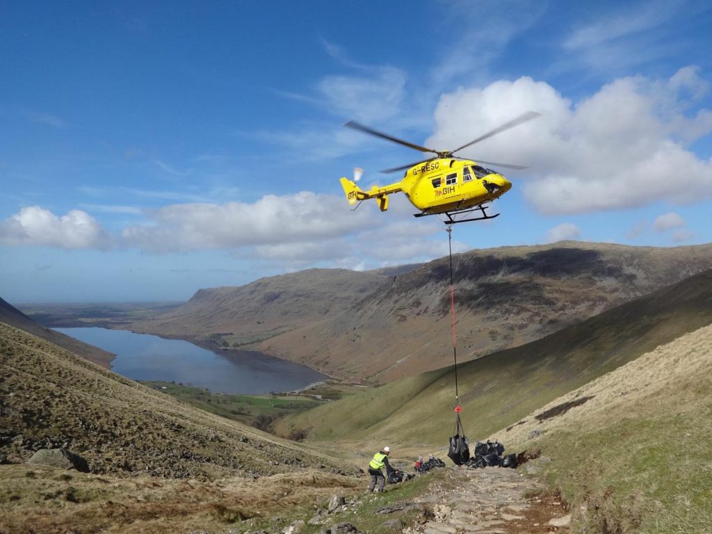
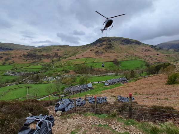
The path up to Glenridding Dodd is a very popular route which has grown in use over the last few years. It is an incredibly steep path which is very significantly eroded – resulting in wide visible scars in the landscape and sections of deep gullying and loose unstable material. The steepness of the terrain and the breadth and extent of loose unstable material severely limits the repair techniques that are viable here. The gradient is too steep for anything other than intermittent stone pitching which will be done by hand on the steepest sections ( totalling 83m) a number of hand built cross drains will be constructed on the upper flatter sections . Landscaping and habitat restoration will be undertaken at the edges – allowing the surrounding vegetation to recover and prevent further loss of soil. The outcome will be a much narrower – more sustainable path. To enable us to undertake this work 101 bags of stone will be required which will be bagged up in 1 tonne bags and flown to site by helicopter.
Whiteless Pike – Footpath
A highly sensitive site in the heart of the High Fells SAC and Buttermere SSSI – this project required a creative approach due to the scarcity of stone in the vicinity and the extent of the work that was required up this popular Wainwright. In 2022 a hand built aggregate zig zag path was built by Rangers to provide a sustainable line for users to walk on. The biggest challenge on routes like this is keeping users on the line – especially on descent when there is a tendency to shortcut at the corners which can cause significant damage. In 2024 the work will involve maintenance of the bench bath and the removal of any old path lines or side path lines to help protect the bench path.
Esk Hause Shelter to Calf Cove – Footpath
The work to be carried out is path definition, the installation of waths (or stone fords), drains and pitching. Any stone pitching which is falling out will be repaired, and landscaping will be completed to define a sustainable path route which will protect the integrity and ecological diversity of a boggy area.
Mousethwaite Comb – Footpath
A popular route up Blencathra. Rangers and Volunteers will carry out work to widen the existing path, carry out path definition, turf island replacement and landscaping work.
Stony Rigg to the Knott via Angle Tarn – Footpath
This is part of the Coast-to-Coast route. The work will be a mix of stepping stones, a wath (or stone ford), subsoil path and hagg reprofiling.
Watendlath to Dock Tarn Rosthwaite – Footpath
The work to be carried out is path definition, waths, drains, pitching and steps which need to be installed on a shelf of bedrock approximately 1-1.2m high.
Catbells – Footpath
The need for erosion repair and mitigation on this ever-popular fell is ongoing and throughout the 2024 season, Rangers will host volunteer work parties twice a month, to define and landscape around the path in order to create a sustainable route and protect the surrounding fell-side.
The Band – Footpath
The mid-section of The Band is characterized by boggy, peaty patches. Short sections of pitching and new drains will be installed by Volunteers to take water off the path and provide a single sustainable line.
Raven’s Edge – Footpath
A popular walk starting from the Kirkstone Inn (436 metres). This hidden valley has grown in popularity and a number of erosion scars and peat haggs are emerging. Stepping stones, causeways and sections of pitching will be put in by Volunteers under the supervision of a specialist volunteer development ranger, to reduce erosion and to protect the landscape going forward.
Greenside Mine to Red Tarn – Footpath
Red Tarn is a popular rest stop for those descending from Hellvellyn. The path has been eroded by way of gullying and Volunteers will carry out drainage and revetment work to shore up path and prevent further acceleration of gullying
Wythburn – Bridleway
A very busy route up towards Helvellyn / Nethermost Pike. Volunteers will carry out stone pitching, drain repair and installation, path definition and landscaping work.
Old Man of Coniston Upper – Footpath
Rangers and Volunteers will work on the upper sections of the path up to the summit of The Old Man of Coniston repairing and installing drains, repairing and replacing stone pitching and blocking side paths to encourage path users to remain on the defined path.
Ongoing Maintenance and Minor Repairs
The 400 sections of path that have been worked on and monitored in previous years will continue to be maintained on a traffic light system. Paths are rated according to the number of times our volunteers and Rangers need to return to them in order to clear the drains and sweep the stone pitching of any loose stones. This varies from once or twice a year, to every two months for some of the most heavily used paths. In addition, Fix the Fells Rangers and volunteers undertake a broad programme of minor repair works, particularly on well used paths and popular mountain routes.
Minor repairs will be carried out by volunteers on a number of additional paths throughout the season under the supervision and guidance of a specialist volunteer development ranger . This ability to respond in a timely manner to reports of minor issues can prevent problems from escalating in scale and urgency but there is always SO much more than we have the time, money or resource to tackle .
Please play your part by treading lightly and sticking to a sustainable surface if there is one so we can all continue to enjoy this special place for many generations to come.